Implementation of the FRA
Since 2008, ARCH has been working for the proper implementation of this Act in the tribal districts of Gujarat. Its approach has been to train the Gramsabhas and the FRCs, enabling them to properly perform the tasks that they have to perform under the FRA. For this, we prepared and distributed a booklet in vernacular Gujarati explaining in a simple language provisions of the FRA and rights and duties of the Gramsabhas and the FRCs. This booklet became very popular across all tribal districts and even the government officers use it for ready reference.
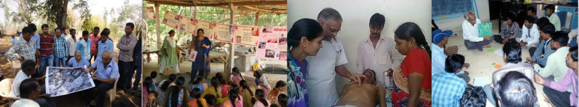
ARCH interacted intensively with the FRC members of the villages in the Shoolpaneshwar Sanctuary area and developed a step by step guide on:
Remove the row
1. How to fill out the application forms
2. Which types of evidence to attach
3. How to carry out field verification and prepare field verification ‘Panchnama’
4. How to record statements from the village elders and witnesses
Remove the row
5. How to give notice to the Forest Department and record their statements
6. How to obtain and verify government records
7. How to record their findings
8. How to pass final resolutions recommending approval or rejection of the claims
We also developed various formats for all these processes, which the FRCs can use, so that they don’t have to spend lot of time and energy in writing down common repetitive sentences.
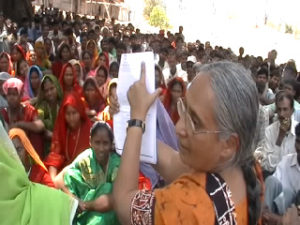
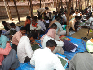
These formats became very popular and were passed to FRCs of all 12 tribal districts through Adivasi Mahasabha network. Training camps were held in all districts with the help of this network, where 300-500 FRC members actively participated each of these workshops.
It was particularly emphasized during these workshops that FRCs and the Gramsabhas have to act as quasi-judicial bodies in these proceedings and must base their decisions on evidence. List of acceptable evidences, that can show occupation of land from 2005 was prepared and discussed. This was very important, as the claimants are required to prove occupation from 2005 and in most of the cases their cultivations are not recorded by the Forest Department in its records.
It was pointed out that in absence of Forest Dept records, other documents like applications made in past (before 2005), records of past court proceedings or orders, physical attributes of the land indicating long occupation like planted trees, farm bunds, etc., statements by village elders and other witnesses, etc. are acceptable and that each claim must have at least two evidences in their support.
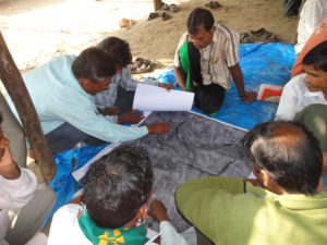
In about 25 villages of Shoolpaneshwar Sanctuary area, ARCH also downloaded Satellite Imageries from Google earth, after overlaying the village boundaries on them and gave print out of these images to the FRC members. It then asked them to see, if the can identify anything on these images.
To their pleasant surprise, they found that the FRC members could interpret the images very well and could locate and identify the lands claimed by each of the claimant. Initially, they took some time (about 15 minutes) to get proper orientation, but then after identifying one plot or object, they could easily identify all plots and objects on the images.
These images from Google are from 14th February, 2005 (i.e. before December, 2005). Hence they could easily provide additional evidence of cultivation. FRA has also recognized Satellite Imageries as acceptable evidence. Hence the FRCs of these villages identified and marked the plots of each of the claimants on these imageries and submitted them as additional evidence to the SDLCs.
By April 2009 most of the Gramsabhas / FRCs had completed their tasks and started submitting the claim files to the SDLCs for further action. In all about 182,000 families had filed claims for individual rights over forest lands across 12 tribal districts. About 8000 claims for community rights over forest resources were also filed. The number of community claims was low, as many of the FRCs were not aware about this. But afterwards, they also started filing claims for these rights.
Training on filling out forms
Once the implementation process was on its way and forms for filing claims were distributed by the government, the first major challenge faced by the people was regarding filing these forms. Most of the tribals could not understand what to write in response to the questions in the form, which is in a cumbersome language containing legal terminology. Again, they are best placed to know who have been cultivating which forest lands from when, but putting all this information on paper and preparing claims with documentary evidences that can withstand legal scrutiny is something that they have never done before. We prepared a 13 page guideline (see the Guidelines – claims) giving step by step instructions on how to fill these forms with model proforma formats for various statements to be submitted by the village elders and other witnesses. We together with other NGOs conducted training shibirs all across the state to explain these guidelines.
Substantiating the Claims
Assisting villagers in Field Verification, where they had to go on to the land and describe what they saw in the field. This has progressed to using hand-held GPS devices and corresponding satellite images from Google to officially map out the plots.
We overlaid village and forest boundaries on the satellite (Google Earth) imagery and then gave large print-outs of maps to the FRCs of our organizational villages. This was the first time they were looking at a print-out of a satellite image and, in fact, had earlier not even heard about satellites and how they can take pictures. Hence, we were not sure whether they would be able to properly interpret these images or not. But their enthusiasm surpassed all our apprehensions. Everybody gathered around these maps discussing what was what and soon got their bearings and started identifying different fields. They also corrected the errors in marking the boundaries of villages.
Then they marked all fields claimed by the tribal claimants of their villages on these maps, by putting their unique Plot Numbers of the fields at appropriate locations. After thus marking these Plots, the FRCs examined each plot and arrived at a finding on whether it is seen as cultivated plot in 2005 Satellite Imagery or not and together with other evidences also took this finding into account while arriving at its recommendation on whether the claim should be approved or not. During March to June 2009, they submitted the files to the Sub-Divisional Level Committee (SDLC) for further action.
Remove the row
Column: 1
Column: 2
Getting the claims approved
The Forest Rights Committee then reports the plots allocations to the Gram Sabha, an authority of village elders, who is the first authority to decide on the legitimacy of the claims. From there it is taken to the sub-division and then district levels of government for approval.
What the Government Did
The FRCs had started submitting claim files to the SDLCs from February March, 2009. The SDLCs had not even examined most of these files, when the Chief Secretary of the State declared in May 2009 that only about 10% of the 182,000 claims filed under FRA were genuine and rest all were bogus. As mentioned above, the SDLCs had not even examined the claim files yet and as such there was no basis to make this statement. Yet it was made. This gave in indications to the district officers that only about 10 % of the claims are to be approved.
Most of the SDLCs sent the claim files to the Forest Department for its recommendations and the FD recommended only those claims which were supported by its records (i.e. only those claims in which it had collected fines from the farmers before 2005 for their cultivations and given receipts for the same) and recommended rejection of all other claims that were not supported by its records. considered all other evidences as not acceptable. It did not even looked at the maps with Satellite Imageries that were submitted by the FRCs.
By April 2010 only about 17, 000 claims from a total of 182,000 claims (9%) were approved by the SDLCs and DLCs. Rest of the claims were kept pending for the time being.
Meanwhile, in January 2010, the state government declared that it would use Satellite Imageries to decide all pending claims that were not supported by FD records and asked Bhaskar Acharya Institute of Space Applications and Geoinformatics (BISAG), a State Government Agency, to acquire Satellite Images of 2005 from the National Remote Sensing Agency (NRSA), Hyderabad and to prepare maps.
BISAG acquired imageries from NRSA, super-imposed village maps on the same and then sitting in the office, its staff identified and marked areas that appeared to be under cultivation (within forest areas) as common plots. And then took out prints of these maps and gave them to the district authorities to identify the persons whose lands fall within these common plots. This task was done in great haste, sitting in the office, without taking the FRCs into confidence. As such, most of these maps had lots of mistakes. Many areas, clearly seen in the image as under cultivation, were left out by the BISAG team and not marked as common plots. And the district officers were instructed to consider these maps as final with no scope for any correction.
Also as the maps were prepared in the Gandhinagar office, they could not identify the persons whose lands may be falling within the common plots. If this task was given to the FRCs, they could have easily identify which plot belonged to which claimant, as they had done before. But their opinion was not at all taken.
Most of the SDLCs did not use these maps at all and yet rejected most of the pending claims. They also claimed that this was done because these claims were not supported by even Satellite Images. BISAG had started supplying maps from May 2010. By October 2010, the SDLCs had already rejected about 70,000 claims and by April 2011, they had rejected 128,000 claims. The figure of approved claims had risen to 36,000 claims (most of them approved because they had documentary evidence of FD records).
What ARCH did
Meanwhile, learning that the State Government was going to use Satellite Images and that it may use GPS surveys for the purpose, ARCH and the FRCs with which it worked, acquired a few GPS devices and learnt how to use them to measure lands. They carried out GPS survey of all the claimed lands and in a few villages and super imposed their results on the Satellite Imageries of 2005. This clearly showed what was the actual condition of the each claimed plot of land in 2005 and also what it area was. This also helped in preparing village level maps showing all plots of lands that are claimed by the claimants under FRA. These maps clearly showed that contrary to the government claim, the satellite imageries were actually showing that most (80-90%) of the claims were indeed genuine.
Encouraged by this result the FRCs of 25 villages decided to carry out the GPS surveys on their own without waiting for the government decision and prepared maps with Satellite Images. All these maps clearly showed that BISAG maps were wrong and Satellite Images were actually supporting the claims.
Meanwhile, ARCH obtained information regarding all the minutes of the meetings of SDLCs and DLCs of all 12 (now 14) tribal districts through the Right To Information Act (RTI) and analyzed reasons given for rejections and prepared a table showing the results.
Armed with these maps and also with other information obtained from the districts under RTI, in August, 2011, ARCH filed a PIL in the Gujarat High Court stating that the State Government had issued illegal instructions that had led to wrongful rejection of large number of claims and praying that all these orders of rejections must be quashed and set aside and the Government must be asked to reconsider all these claims.
The case was so strong, that in October, 2011 the state government took a decision to review all the rejected claims and asked the court to dismiss the petition as they are in any case reviewing the rejected claims. ARCH challenged this claim and argued that reviewing using the same evidence would lead to the same results again hence detailed directions must be given on which evidence to consider.
After hearing detailed arguments, in May 2013, the HC gave a
landmark judgment (Gujarat High Court Judgment in Petition – ARCH & Ors V/s State of Gujarat & Ors (WP 100/2011)). In this judgment it has granted most of the ARCH’s prayers and asked the State Governments to review all rejected claims and decide them considering all evidences that are acceptable under the Act and not just the FD records. It also issued detailed instructions on which evidences to consider and also instructed that it shall not rely on BISAG maps, but consider other maps with Satellite Imageries, that may be submitted by the FRCs. This fully vindicated ARCH’s stand on Satellite Imageries.
Meanwhile villages from surrounding areas and also other districts saw these maps and started saying that they would also like to carry out GPS surveys and obtain maps with satellite imageries. ARCH acquired about 30 GPS devices for this purpose and rotated them in different villages. Till now more than 20,000 plots of nearly 15000 claimants from Narmada, Dangs, Valsad, Vadodara, Bharuch, Tapi, Panchmahal and Dahod districts have been surveyed and mapped, which shall be used by the FRCs and the claimants during review proceedings.
Liberty Institute, Delhi also became interested in this work and together with it ARCH developed a website www.righttoproperty.org to get groups working in other states interested in this work. ARCH and LI also organized many workshops with different groups in Orissa, Jharkhand, MP, Chhattisgarh, Bihar, etc. Many of these groups are likely to initiate similar work in their respective areas.
Post High Court Judgement
The High Court directed the State Government to review all rejected claims and to consider all types of acceptable evidences while reviewing these claims. It also directed the State Government to expedite the process of recognizing community rights over forest resources.
After this judgment, by July 2017, the figure of approved claims in Gujarat has risen to 81,350, which is 45% of the total 182,000 claims. While the remaining claims are still pending. And about community rights over forest resources have also been approved for about 3000 villages.